How I Identified This University Using GEOINT
Objective: Identify the university and the city where the image was taken.
Challenge Overview
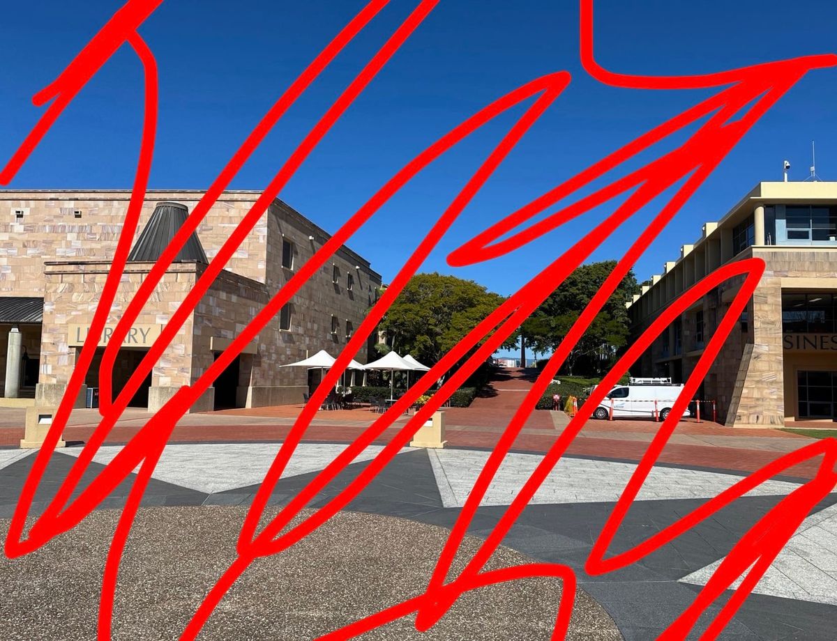
The challenge provided a single outdoor image captured within what appeared to be a university campus.
The objective was to determine:
- the name of the university,
- and the city where it was located.
Reverse Image Search
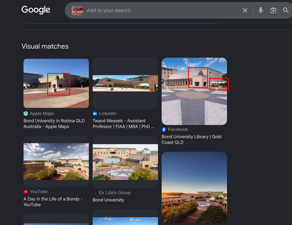
Once the initial observations were documented, I pivoted into reverse image searching to identify visually similar locations.
Platforms used:
- Google Images
- Bing Visual Search
- Yandex Images
Among the three, Google Images produced the most relevant results.
After reviewing several visually similar matches, I came across imagery strongly resembling Bond University located in Australia.
Bing and Yandex returned comparatively broader and less relevant matches for this particular image.
Geolocation Verification
After forming a likely match, I moved to Google Maps and Street View to verify the location manually.
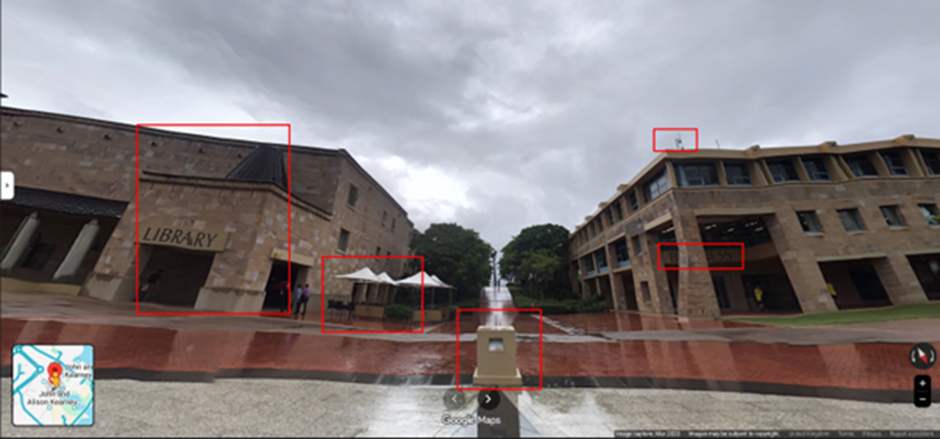
I primarily used the library building as the main reference point while comparing the campus layout against the challenge image.
During the Street View analysis, multiple visual indicators aligned successfully:
- Building positioning
- Stone architecture
- Outdoor seating area
- Tree placement
- Walkway alignment
- Flooring pattern featuring the large star-shaped design
Most importantly, the partially visible “SINES” text was confirmed to belong to the Bond Business School building, validating the earlier hypothesis.
At this stage, the location match became highly reliable.
Final Identification
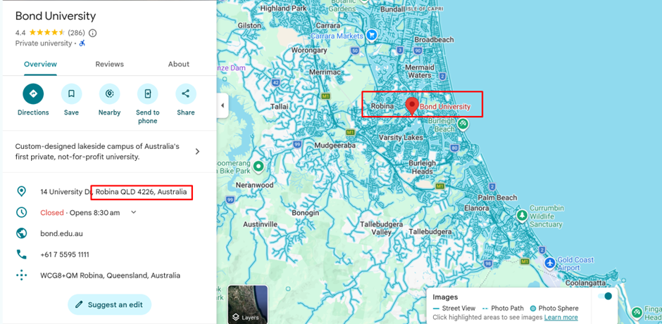
The image was identified as:
- Bond University
- Located in Robina, Gold Coast, Queensland, Australia
Coordinates
28°04'23.5"S 153°24'59.5"E
Tools Used
- Google Images
- Bing Visual Search
- Yandex Images
- Google Maps
- Google Street View
Closing Thoughts
This challenge was a good reminder that even small environmental indicators can become strong investigative pivots when combined together.
Rather than relying on a single clue, the identification came from layering multiple observations:
- partial signage,
- architectural style,
- environmental context,
- and manual geolocation verification.
It was also a useful example of how initial assumptions can evolve during an investigation. What initially appeared to be mountainous terrain ultimately turned out to be part of the coastal geography surrounding the Gold Coast region which reinforces the importance of validating hypotheses rather than just relying on first impressions.