Tracing an Unknown Island Resort Through GEOINT
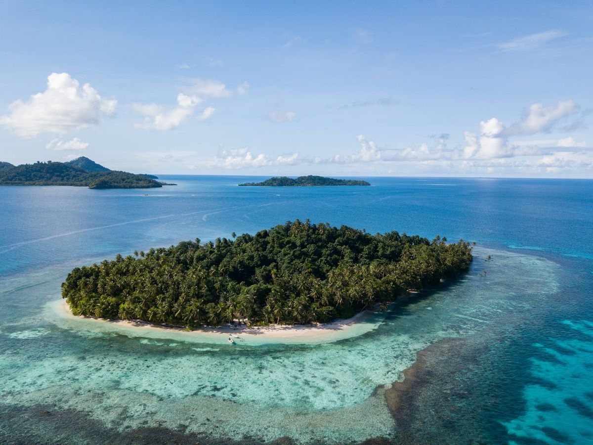
Objective: Identify the resort, determine the island's coordinates, and establish the cardinal direction the camera was facing when the photograph was taken.
Challenge Overview
This challenge provided a single photograph of a tropical island resort with very little contextual information. My objective was to determine:
- The name of the resort
- The coordinates of the island
- The cardinal direction the camera was facing when the photograph was taken.
Examining the Image
Rather than immediately relying on search tools, I first spent time observing the image to identify anything that could narrow the investigation.
Though the photograph didn't contain any obvious signage or landmarks, several environmental features stood out:
- A small tropical island surrounded by clear water
- Two or three nearby islands visible in the distance
- Dense palm tree vegetation
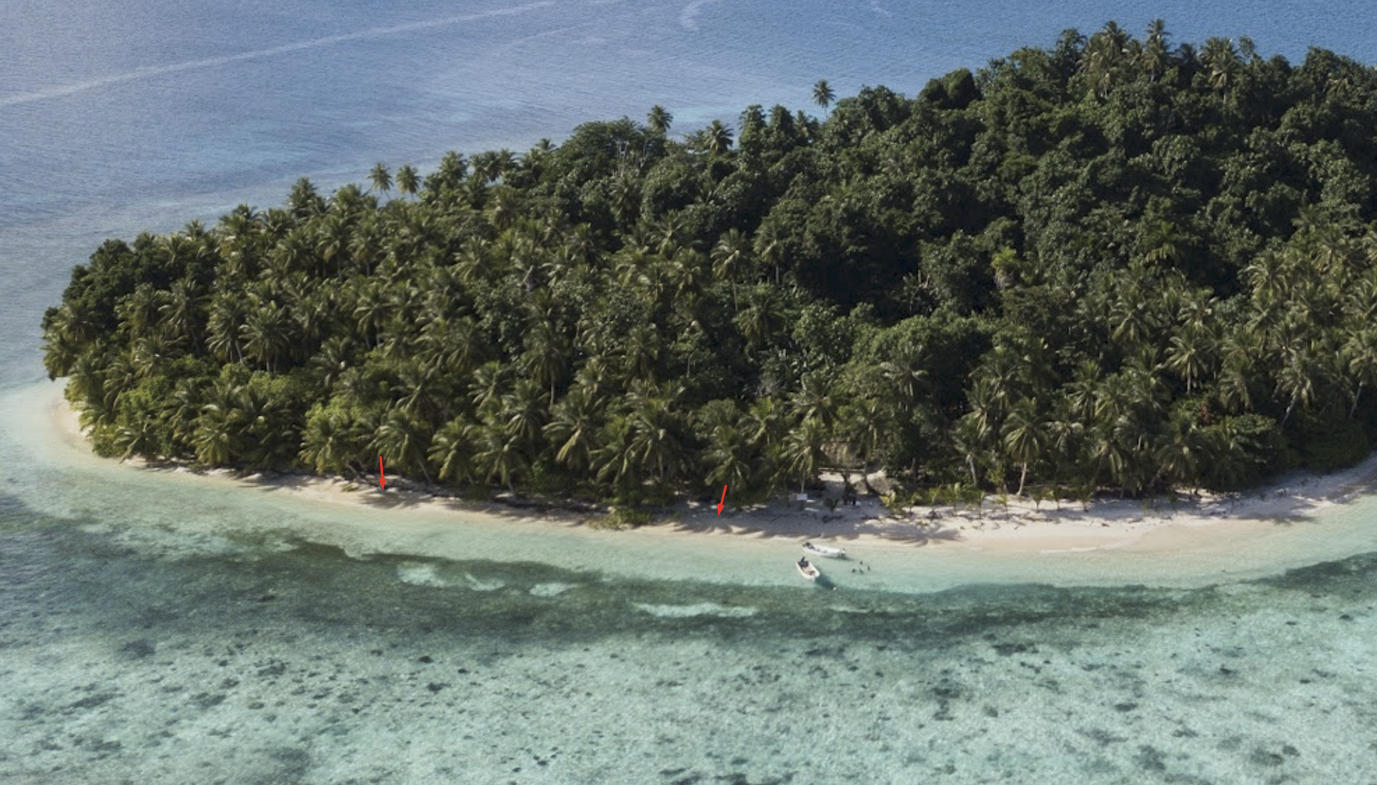
- Palm tree shadows of varying lengths
- Two small boats positioned along the shoreline
One of my initial thoughts was that the location could potentially be somewhere around Bali or a similar tropical island, based on the dense palm vegetation and overall landscape. It wasn't a strong conclusion, but it gave me an early geographic direction before I gathered more evidence.
I also paid attention to the palm tree shadows. Since most of them appeared relatively short and remained close to the trees, I suspected the sun was positioned fairly high in the sky. But this observation wasn't enough to determine the exact camera direction, I kept it in mind as a potential clue for later verification.However, together they provided a useful visual profile that I could later compare against potential matches.
Reverse Image Search
After exhausting the available visual clues, I pivoted to reverse image searching.
Using Google Images, I searched for visually similar photographs.
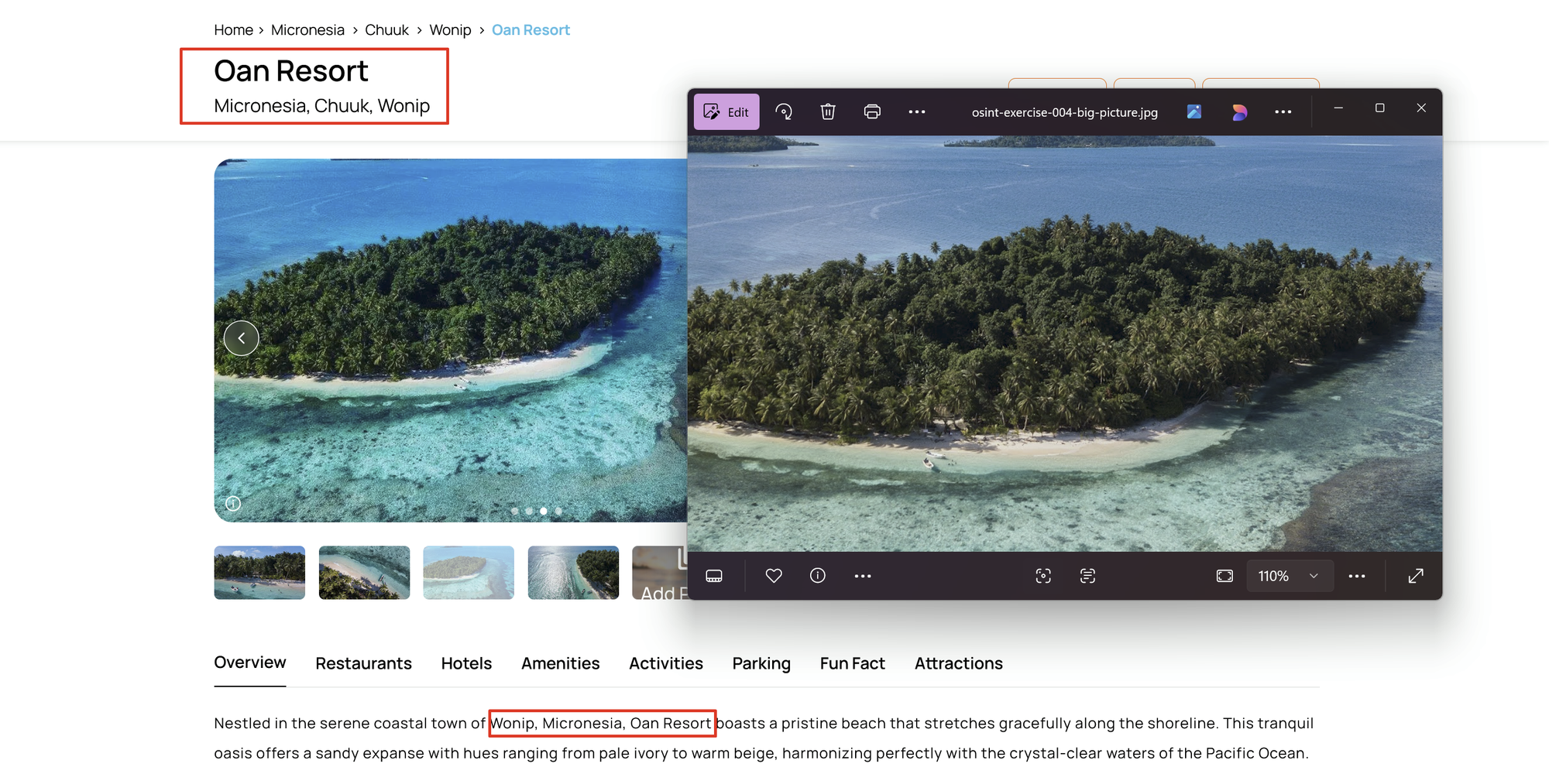
The search easily produced multiple identical matches, and one of the results identified the location as Oan Resort, located on Oan Island in Wonip, Chuuk, Micronesia.
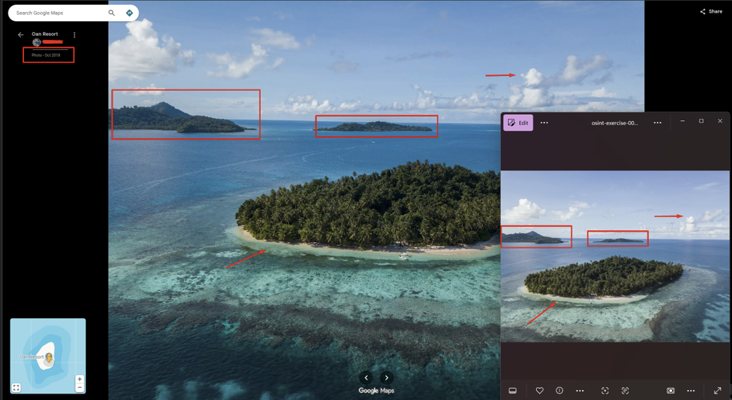
Rather than immediately considering it as final location, I compared the photograph details against the image available on the source.
Several details matched closely:
- The arrangement of the surrounding islands
- Palm tree placement
- Shoreline layout
- The two boats near the water
- The distant island backdrop
This gave me a strong lead, but I still wanted to independently verify the location.
Verifying the Location
I next used Google Maps to verify the information.
While exploring photos contributed by visitors over different years, I found the exact same image uploaded in October 2018, captured from the same viewpoint.
The matching photograph confirmed several observations from my initial image analysis, including:
- Island shape
- Shoreline
- Palm tree distribution
- Boat locations
- Background islands
This was a strong confirmation that the identified location was correct.
To determine the island's coordinates, I searched for Oan Island and confirmed its position on the map.
Coordinates:
7.363416468825753, 151.75583897852593
Determining the Camera Direction
The final flag required identifying the direction the camera was facing when the photograph was taken.
My initial thought was to use the palm tree shadows to estimate the sun's position and then determine the camera's orientation. However, I realised that without knowing the exact time the photograph was taken, using a tool like SunCalc would bring up unnecessary assumptions and may give the unreliable results.
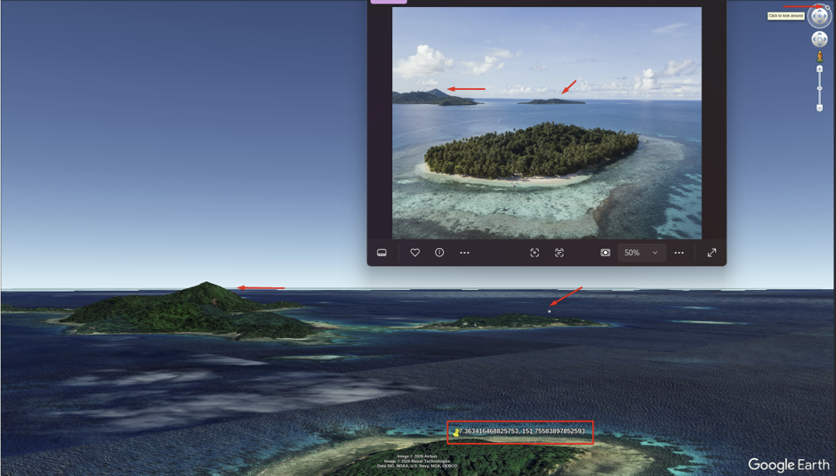
Instead, I chose a more reliable approach. I opened the location in Google Earth Pro. By aligning the surrounding islands with the original challenge image in 3D view and using the navigation compass as a reference, I adjusted the viewpoint until the angle of the viewpoint matched the angle shown in the source challenge image and the positions of surrounding elements, such as nearby islands, aligned correctly.
Once aligned, the compass indicated where north was, and based on that I could determine that the camera was facing northwest when the photograph was captured.
Final Answer
Resort Name:Oan Resort
Island Coordinates:
7.363416468825753, 151.75583897852593
Camera Direction:
Northwest
Tools Used
- Google Images
- Google Search
- Google Maps
- Google Earth
Why I Chose This Approach?
I initially considered using the palm tree shadows to estimate the camera direction. However, without knowing the photograph's capture time, I couldn't confidently model the sun's position. Reconstructing the viewpoint in Google Earth proved to be a more reliable method for answering the final question.