Tracing an Airbase Linked to Cold War Arms Smuggling
Challenge Overview
This challenge revolved around a fictional arms smuggling operation involving Russian military parts being transported through multiple airbases before reaching a central hub.
The challenge narrative pointed toward a network connected to former Cold War associates and international military logistics. My task was to identify the airbase shown in a satellite image and uncover its location.
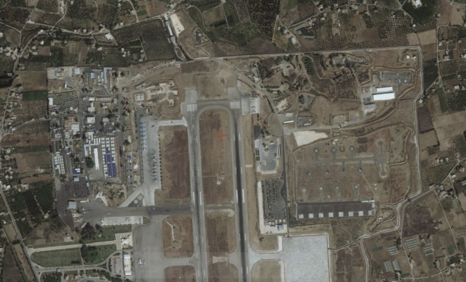
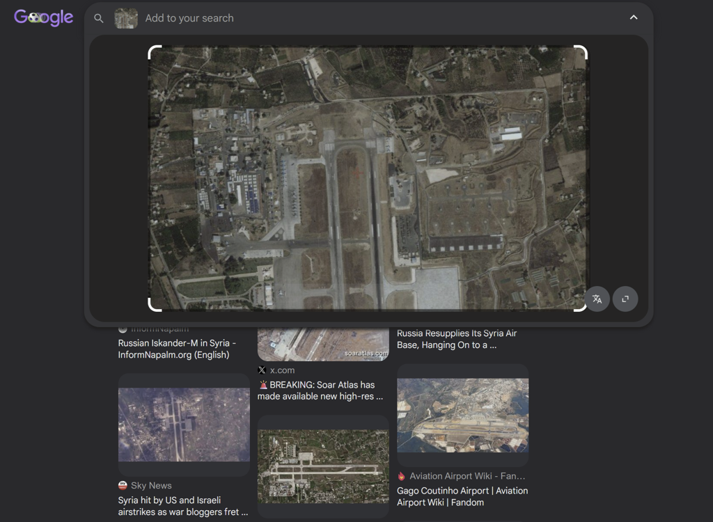
The only evidence provided was the image below.
Examining the Image
My first step was to inspect the image itself and look for any clues that could help narrow down the location.
Several characteristics of the image caught my attention during the initial review:
- A long runway running through the center of the image
- Multiple aircraft positioned around the airfield
- A row of aircraft visible on the left side of the runway
- Large open areas surrounding the base
- Vegetation and farmland-like terrain around the perimeter
While these observations helped establish that the image showed an active airbase, none of the visible features were distinctive enough for me to confidently identify the location through visual analysis alone.
The image contained no useful EXIF or location-related metadata that could assist with identification.
Pivoting to Reverse Image Search
Since the image lacked unique visual identifiers and I couldn't confidently narrow the location through manual analysis alone, I decided to pivot to reverse image searching.
Using Google Images, I searched for matches to the satellite image. The challenge narrative repeatedly referenced Russian military equipment and operations, which helped narrow my focus while reviewing the search results.
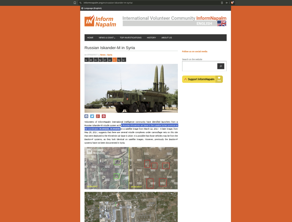
The reverse image search quickly produced several results linking the image to Khmeimim Air Base, a Russian-operated airbase located in Syria's Latakia Governorate.
I found a source that explicitly identified the airbase as Khmeimim Air Base and provided its coordinates - 35.403243, 35.954038
This gave me a strong lead, which I then set out to independently verify using satellite imagery and map-based comparison.
Verifying the Location
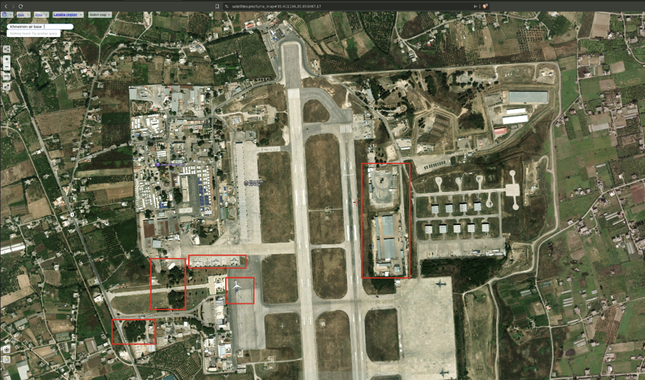
To confirm the lead, I opened the coordinates in satellite imagery and compared them against the challenge image. Using Satellites.pro, I examined the airbase layout and looked for matching features.
Several elements aligned closely:
- The runway orientation
- Aircraft placement around the airfield
- The row of aircraft visible on the left side of the runway
- Surrounding vegetation
- Nearby infrastructure and road patterns
The aircraft arrangement was particularly convincing, as it closely matched what was visible in the challenge image. After comparing the two images side by side, I was confident that the location had been correctly identified.
Final Answer
The airbase shown in the challenge image was:
Khmeimim Air Base
- Jableh District
- Latakia Governorate
- Syria
Coordinates:
35.403243, 35.954038
Flag:
Syria-Latakia-Jableh-Khmeimim-air-base
Tools Used
- Google Images
- Google Search
- Satellites.pro
- EXIF Viewer
Closing Thoughts
This challenge was a good reminder that not every GEOINT investigation can be solved through image analysis alone.
While the satellite image provided useful context, it lacked enough unique identifiers for a confident manual geolocation. Rather than forcing an approach that wasn't producing results, I switched tactics and used reverse image search to generate a lead.
The most important part of the investigation wasn't finding the lead, it was verifying it.